

Cargo vehicle tracking best practices for 2026

Cargo vehicle tracking best practices are defined as the combination of GPS technology, IoT sensors, and workflow integration that delivers real-time, actionable freight visibility across your entire fleet. Done well, tracking goes far beyond dots on a map. Platforms like Samsara, Geotab, and FleetOpsClub demonstrate that the highest-performing fleets link location data directly to operational workflows, phased deployment strategies, and standards like DCSA’s Track & Trace to eliminate data silos. The result is measurable improvement in delivery performance, driver acceptance, and compliance. This guide gives you the framework to achieve exactly that.
What are the best cargo vehicle tracking methods for your fleet?
The right tracking technology is determined by asset type, lane, and cargo risk profile, not by what is most popular or most expensive. Choosing the right method depends on matching device capability to operational reality, and getting this wrong wastes budget without improving visibility.
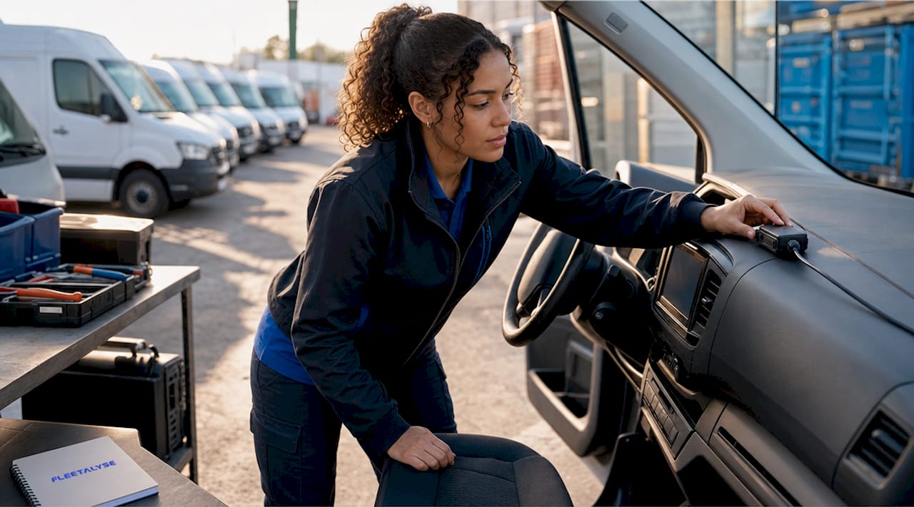
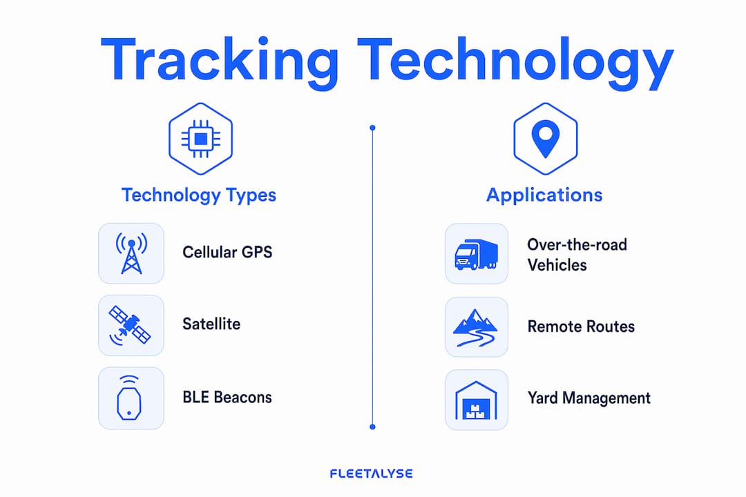
Cellular GPS trackers are the standard choice for over-the-road HGVs and vans operating within network coverage. They deliver frequent location pings at 10 to 60 second intervals, which is sufficient for live dispatch and route verification. Faster ping rates increase data costs and battery consumption, so sub-10-second intervals are reserved for emergency vehicles or customer-facing live tracking portals. For most UK fleet operators, a 30-second ping interval balances cost and visibility effectively.
Satellite tracking fills the gap where cellular coverage fails, particularly for ocean freight or remote routes. Hybrid cellular and satellite connectivity, as used in next-gen container tracking, provides continuous location and condition data near shore and across open ocean. This matters most for cold chain operators and high-value cargo lanes where a coverage gap is not acceptable.
For yard management and carton-level tracking, BLE beacons and disposable smart labels offer cost-effective alternatives. Disposable smart labels cost approximately £8 per unit and suit single-use shipments where a permanent device is impractical. IoT condition sensors add temperature, humidity, and shock monitoring for sensitive cargo such as pharmaceuticals or fresh produce. Battery-powered trackers are the correct choice for trailers sitting idle in yards, where a hardwired device would drain vehicle power during long dwell periods.
The table below summarises the key options and their best applications.
| Technology | Best application | Advantage | Limitation |
|---|---|---|---|
| Cellular GPS | OTR HGVs, vans, urban fleets | Low cost, high update frequency | Requires network coverage |
| Satellite GPS | Ocean freight, remote routes | Global coverage | Higher cost, slower updates |
| BLE beacons | Yard management, pallet tracking | Low cost, no SIM required | Short range only |
| IoT condition sensors | Cold chain, pharma, perishables | Monitors temperature, humidity, shock | Adds hardware complexity |
| Disposable smart labels | Carton-level, single-use shipments | Cheap, no recovery needed | Limited data, one-use only |
Pro Tip: Avoid purchasing a platform with every feature available before you have established baseline metrics. Start with GPS location and two or three alerts, then add condition monitoring and geofencing once your team is comfortable with the data.
How to implement a phased rollout for maximum ROI and adoption
A phased rollout is the single most effective way to reduce driver resistance, avoid alert fatigue, and demonstrate measurable return on investment before committing to full deployment. Fleet operators who attempt to activate every feature on day one typically find their teams ignoring alerts within weeks.
The recommended approach, supported by FleetOpsClub’s 2026 guide, is to start with three core alerts and expand from there. Follow this sequence:
- Weeks 1 to 4: Install devices across your pilot vehicles, ideally using OBD-II plug-in units for speed. Activate three alerts only: idle time over 15 minutes, after-hours movement, and speeding more than 10 mph over the posted limit.
- Weeks 5 to 8: Review alert data and adjust thresholds based on your fleet’s actual behaviour. Identify false positives and refine rules before adding complexity.
- Weeks 9 to 12: Introduce geofencing alerts for key locations such as customer sites, depots, and fuel stops. This is where operational workflow integration begins.
- Day 90: Run a formal ROI analysis. Calculate fuel savings from idle reduction, overtime reduction from after-hours alerts, and any insurance premium changes. Use this data to justify full fleet rollout.
- Month 4 onwards: Expand to condition monitoring, driver behaviour scoring, and TMS integration based on validated business case.
Driver communication is not optional. Research from Verizon Connect shows that driver resistance drops by 60% when operators provide a written GPS policy and hold in-person briefings explaining what data is collected, how it is used, and what it is not used for. Frame tracking around safety and service quality, not surveillance. Ask drivers to sign the policy document so expectations are clear on both sides.
Pro Tip: When scheduling installations, use mobile install teams that visit your depot rather than requiring vehicles to travel to a fitting centre. For mixed fleets with HGVs and vans, prioritise OBD-II plug-in units for vans and hardwired units for HGVs where CAN-bus data is needed.
How does geofencing automate cargo tracking workflows?
Geofencing is the practice of defining a virtual boundary around a physical location so that when a vehicle enters or exits that zone, a pre-configured action is triggered automatically. Most fleet operators use geofencing only to generate location alerts. The operators who extract the most value wire those geofence events directly into their TMS, WMS, and customer notification systems.
Event-driven geofencing eliminates manual check-in calls, automates dock assignments, validates appointment times, and tracks detention automatically. The practical outcome is significant: geofencing that triggers TMS and WMS workflows reduces WISMO (Where Is My Order) calls by up to 60%. That is a direct reduction in customer service workload and a measurable improvement in customer satisfaction scores.
The key operational benefits of workflow-integrated geofencing include:
- Automated dock assignment: When a vehicle enters a customer site geofence, the system assigns a dock bay and notifies the warehouse team without a phone call.
- Detention tracking: Entry and exit timestamps are recorded automatically, creating an auditable record for billing disputes without relying on driver memory or paper logs.
- Appointment validation: If a vehicle arrives outside its booked window, the system flags the exception and notifies the planner in real time.
- Customer notifications: Automated ETAs and arrival confirmations are sent to customers when vehicles hit defined proximity triggers, reducing inbound calls.
- Carrier performance scoring: Geofence data feeds directly into on-time performance metrics, giving you objective data for carrier reviews.
Dynamic and polygonal geofencing improves accuracy over simple circular zones, particularly at complex sites like ports, distribution centres, and multi-tenant industrial estates. Privacy and consent are also non-negotiable. Under UK GDPR, drivers must be informed that location data is collected, and data retention policies must be documented. Retaining geofence event data for a minimum of 12 months is advisable for dispute resolution and compliance purposes.
Pro Tip: Configure separate geofence zones for vehicle approach (500 metres out) and arrival (on-site). The approach trigger sends the ETA notification; the arrival trigger starts detention timing. This two-stage setup prevents false triggers from traffic queues near busy sites.
Why do cargo tracking standards and data quality determine long-term success?
Data quality and interoperability are the factors that separate a tracking system that works on day one from one that scales reliably across your supply chain. Without standards-based data exchange, you end up with brittle point-to-point integrations that break when a carrier changes their API or a new partner joins your network.
The DCSA (Digital Container Shipping Association) sets the benchmark for container tracking interoperability. The DCSA 2026 roadmap targets Track & Trace version 3.0 beta in March and April 2026, replacing siloed spreadsheet-based reporting with real-time API data handoffs across the full shipping lifecycle. This means carriers, terminals, and shippers can exchange location and event data without manual re-entry, reducing errors and enabling supply-chain-wide visibility. Adopting standards-based APIs rather than custom integrations is the correct long-term approach for any operator managing multi-carrier or multi-modal freight.
For UK road freight operators, the equivalent principle applies at a smaller scale. Layering carrier API data with your own device-based tracking on high-value lanes gives you redundancy. If a carrier’s data feed goes silent, your own hardware fills the gap. This approach also protects against “silent failure,” where a sensor or tracker stops reporting without triggering an alert. Monitoring data completeness, not just data content, is a discipline that separates mature tracking programmes from basic ones.
The table below summarises the key standards and their operational relevance.
| Standard | Purpose | Operational benefit |
|---|---|---|
| DCSA Track & Trace 3.0 | Container event data exchange | Real-time visibility across carriers and terminals |
| UN/CEFACT | Cross-border trade data formats | Reduces customs and documentation errors |
| NMEA 0183 / 2000 | GPS data output format | Ensures device compatibility across platforms |
| ISO 23512 | IoT sensor data for cold chain | Standardises condition monitoring alerts |
IoT expansion into reefer containers and environmental monitoring is a direct outcome of the DCSA roadmap. Condition alerts for temperature excursions, humidity spikes, and door-open events are now part of the Track & Trace event catalogue, not an add-on. For cold chain operators, this means compliance evidence is generated automatically rather than relying on manual checks.
Key takeaways
Effective cargo vehicle tracking requires matching technology to asset type, deploying in phases with clear driver communication, and wiring geofence events into operational workflows rather than treating location data as an end in itself.
| Point | Details |
|---|---|
| Match technology to asset | Use cellular GPS for OTR vehicles, satellite for ocean freight, BLE beacons for yard assets, and IoT sensors for sensitive cargo. |
| Deploy in phases | Start with three alerts, add geofencing at 60 days, and run a formal ROI analysis at 90 days before scaling. |
| Communicate with drivers | A written GPS policy and in-person briefings reduce driver resistance by 60%, according to Verizon Connect data. |
| Integrate geofencing with workflows | Wire geofence events into TMS and WMS systems to automate dock assignments, detention tracking, and customer notifications. |
| Adopt standards-based data exchange | Use DCSA Track & Trace APIs rather than custom integrations to avoid data silos and support multi-party visibility. |
What I have learned from watching fleets get tracking wrong
I have seen operators spend significant budget on tracking platforms and then wonder why nothing changed. The pattern is almost always the same: the technology was installed, the dashboards were configured, and then the system was left to run without anyone asking what the data should actually trigger.
The most common mistake is treating a tracking platform as a reporting tool rather than an operational one. Real-time maps are useful for reactive decisions. The genuine efficiency gains come from wiring location events into the systems your planners and warehouse teams already use every day. If a geofence arrival does not automatically update your TMS or notify your customer, you are still relying on a phone call to close the loop.
Driver trust is the other area where I see operators underinvest. Announcing GPS tracking without explanation creates suspicion that is very difficult to undo. Drivers who understand why tracking exists and what the data is used for are far more likely to flag sensor faults, report installation issues, and engage with driver behaviour feedback. Positive reinforcement, such as recognising drivers with clean safety scores, builds the culture that makes tracking data reliable.
Alert fatigue is a real operational risk. A system generating 200 alerts a day trains your team to ignore alerts. Start narrow, measure what matters, and expand only when your baseline is established. The same discipline applies to data standards: adopt DCSA-aligned APIs now, even if your current volume does not demand it, because retrofitting interoperability later is significantly more expensive than building it in from the start.
— Vytautas
How Fleetalyse supports best-practice cargo vehicle tracking
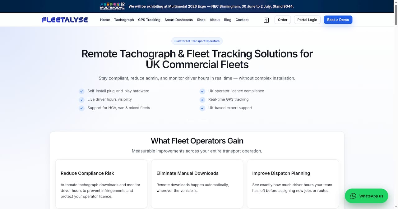
Fleetalyse is built for UK fleet operators who need more than a basic location feed. The Fleetalyse platform combines GPS vehicle tracking, smart dashcams, driver behaviour monitoring, and tachograph compliance in a single integrated system, designed to support exactly the phased, workflow-connected approach described in this article. Hardware options include plug-and-play OBD-II units for fast deployment across van fleets and hardwired telematics units for HGVs requiring CAN-bus data. For trailer and asset tracking, Fleetalyse offers dedicated asset trackers suited to mixed fleets with long yard dwell times. UK-based support means your team gets practical setup guidance from people who understand DVSA regulations and Operator Licence requirements. Speak to Fleetalyse to discuss a tracking deployment that fits your fleet.
FAQ
What is the first step in implementing cargo vehicle tracking?
Start by defining your three most critical alerts, typically idle time, after-hours movement, and speeding, and deploy to a pilot group of vehicles before rolling out fleet-wide. Establishing a baseline before expanding features prevents alert fatigue and gives you measurable ROI data within 90 days.
How does geofencing improve cargo tracking beyond location data?
Geofencing triggers automated actions in TMS and WMS systems when vehicles enter or exit defined zones, removing the need for manual check-in calls and automating detention tracking, dock assignments, and customer notifications. Event-driven geofencing can reduce WISMO calls by up to 60%.
What tracking technology suits temperature-sensitive cargo?
IoT condition sensors combined with cellular or satellite GPS provide continuous location and condition data, including temperature, humidity, and door-open alerts, for cold chain and pharmaceutical freight. Hybrid cellular and satellite connectivity covers both near-shore and open-ocean routes without gaps.
Why does data interoperability matter for cargo tracking?
Without standards-based data exchange, integrations between carriers, terminals, and shippers break when systems change, creating data silos and manual re-entry errors. The DCSA Track & Trace 3.0 standard, targeting beta release in early 2026, replaces these brittle connections with real-time API handoffs across the full shipping lifecycle.
How do you reduce driver resistance to GPS tracking?
Providing a written GPS policy and holding in-person briefings that explain what data is collected and how it is used reduces driver resistance by 60%, according to Verizon Connect research. Framing tracking around safety and service quality, rather than monitoring, and using positive reinforcement for good performance scores builds long-term driver engagement.