
What if your dispatch office never had to make another phone call just to verify a vehicle's arrival at a customer site? You're likely tired of the manual slog. Chasing drivers for ETAs or worrying about unauthorised side jobs during work hours wastes valuable time. It's a constant frustration for UK hauliers, but setting up geofencing alerts for delivery zones provides a straightforward solution to these operational leaks.
We understand that your priority is operational clarity without the marketing fluff. This guide shows you how to configure precise virtual boundaries and automated alerts to streamline your delivery workflows and improve fleet security. By the end of this article, you'll know exactly how to automate proof of arrival, reduce the administrative burden on your team, and protect your assets from unauthorised use. We'll walk through the technical steps of boundary creation, notification logic, and using these tools to maintain your Operator Licence standards through better digital monitoring. This is about building a reliable, rules-based control layer that works for your regional fleet every day.
Key Takeaways
- Automate arrival and departure tracking to eliminate manual check-calls and improve the efficiency of your dispatch operations.
- Discover the difference between radial and polygon zones to ensure high-precision monitoring for complex delivery yards and customer sites.
- Streamline your workflow by setting up geofencing alerts for delivery zones using a prioritised policy that prevents notification fatigue.
- Enhance your Operator Licence compliance by integrating real-time geofence data with live driver hours and tachograph analysis.
- Secure trailers and high-value assets across your national fleet with immediate alerts for unauthorised vehicle use or "side jobs".
Understanding Geofencing Alerts in Modern Delivery Operations
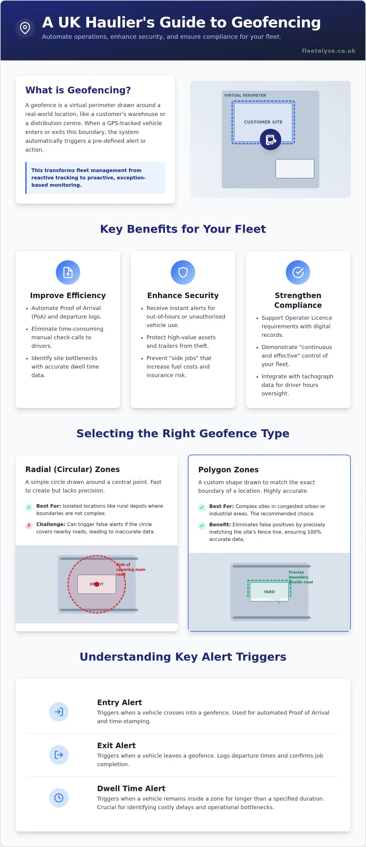
A geofence is a virtual perimeter drawn around a physical location, such as a customer's warehouse or a regional distribution centre. Understanding Geofencing Alerts starts with the GPS hardware installed in your HGVs or trailers. These devices report precise coordinates in real time. When a vehicle crosses the digital boundary you've set, the software triggers an instant notification. This moves your operations from reactive tracking to proactive exception management. You don't need to stare at a map all day. You only act when a boundary is breached. For UK hauliers managing tight delivery windows, setting up geofencing alerts for delivery zones is the most effective way to maintain schedule integrity. It gives you immediate visibility without the need for constant manual monitoring.
The Role of Geofencing in Delivery Efficiency
Manual check-calls are a drain on resources and distract drivers. Geofencing automates the Proof of Arrival (PoA) process. When a driver enters a customer site, the system logs the time automatically. Your customer service team can see this data instantly. It cuts down on the "where are you?" calls that disrupt focus and delay unloading. Beyond individual deliveries, this data reveals hidden bottlenecks. If vehicles are consistently sitting in a specific distribution centre for three hours, the automated entry and exit logs provide the hard evidence needed to address the issue with the site manager. You can identify which sites are efficient and which ones are costing you money in wasted driver hours.
Security and Compliance Benefits
Security is a major concern for UK fleets, particularly with high-value goods. Geofencing acts as a digital nightwatchman. If a van or trailer moves outside of designated working hours, you'll know immediately. This is vital for flagging unauthorised vehicle use or "side jobs" that increase your insurance risk and fuel costs. For those managing a national fleet, tracking trailer locations amongst third-party sites becomes much simpler with GPS fleet tracking. It also supports your Operator Licence requirements. The DVSA expects "continuous and effective" control of your fleet. Using setting up geofencing alerts for delivery zones demonstrates a professional, data-driven approach to asset management and driver oversight. It's a practical tool for keeping your fleet compliant and your assets secure whilst reducing the administrative burden on your transport office.
Selecting the Right Geofence Types for Your Delivery Zones
Not all virtual boundaries are the same. When setting up geofencing alerts for delivery zones, the geometry you choose directly impacts the reliability of your notifications. High-precision boundaries are vital for UK hauliers navigating narrow industrial estates or busy town centres. Whilst basic asset tracking often relies on simple circles, sophisticated delivery operations require specific shapes to match real-world site layouts. Using geofencing for fleet management allows you to tailor your monitoring to the exact footprint of a customer’s yard.
You should understand the three primary alert triggers: Entry, Exit, and Dwell. Entry and Exit are standard, providing the timestamps needed for proof of delivery. Dwell alerts are more advanced, measuring the total time an asset remains stationary within the zone. For transit-heavy operations, corridor geofencing creates a virtual path along specific A-roads or motorways. This ensures drivers stay on approved routes and alerts you if a vehicle takes an unauthorised detour.
Radial vs. Polygon Zones: Which to Choose?
Radial zones are circular perimeters centred on a specific coordinate. They're quick to set up and work well for isolated rural depots. However, they're often too blunt for urban environments. A radial zone might accidentally cover a nearby main road, triggering "false positives" every time a vehicle drives past the site without entering. For most operators, setting up geofencing alerts for delivery zones using polygon shapes is the better choice. Polygon zones allow you to draw custom shapes that follow the exact fence line of a delivery yard. This precision is essential in congested areas like London or Birmingham to ensure your arrival data is 100% accurate.
The Critical Importance of Dwell Time Alerts
Dwell time is the duration a vehicle or trailer stays within a geofence. Excessive dwell time is a major drain on fleet profitability. By setting up a dwell alert, you're notified the moment a vehicle exceeds its expected unloading window. This data is invaluable for transport managers. It provides the objective evidence needed to negotiate demurrage charges with customers who consistently delay your drivers. Instead of relying on anecdotal reports, you have a digital log of every minute wasted. If you want to start capturing this level of detail, you can order your GPS tracking units and begin mapping your key delivery sites today.
Strategic Setup: Creating an Alert Policy That Works
Setting up 1,000 alerts for a fleet of 10 vehicles is a recipe for operational chaos. It leads to alert fatigue, where staff stop checking notifications because there's too much digital noise. Effective setting up geofencing alerts for delivery zones requires a tiered approach. You must decide which zones are critical and which are merely informational. For example, a vehicle leaving your main depot at 2 AM is a high-priority security event. A vehicle arriving at a routine customer site at 10 AM is a low-priority operational update. By categorising your delivery zones by priority, you ensure your team only reacts to events that actually matter. This disciplined approach keeps your transport office focused on exceptions rather than routine movements.
Designing the logic of who receives these alerts is the next step. You don't want to flood everyone's inbox. Use time-based rules to refine this further. If a vehicle is authorised to be at a site between 08:00 and 18:00, you can configure the system to ignore arrival alerts during these hours. This keeps your notification feed clean and focuses attention on out-of-hours movements or unexpected delays. It's about creating a system that assists your staff rather than overwhelming them with data they already expect.
Prioritising Notifications and Recipients
Critical "Exit" alerts should go directly to security or transport managers via SMS for immediate action. These are exceptions that require a quick response. Conversely, "Arrival" notifications are better suited for customer service teams via email. They can then update the client without disturbing the transport office. For non-urgent monitoring, such as long-term dwell time trends, use in-platform dashboards. This allows you to review site performance during weekly meetings rather than reacting to every minute a vehicle is stationary. Matching the notification method to the urgency of the event is key to a smooth workflow.
Fine-Tuning for UK Infrastructure
UK geography presents specific challenges for GPS accuracy. In "urban canyons" like the City of London or narrow streets in Manchester, tall buildings can cause GPS drift. To manage this, you must adjust your buffer zones. A buffer zone is a 10-20 metre margin of error added to your perimeter to prevent erratic alerting caused by slight signal bounces. You should also consider reporting intervals. Whilst a 30-second interval provides high accuracy, it may drain the battery of non-powered asset trackers. Balance is key. When setting up geofencing alerts for delivery zones, start with a 60-second interval and a 15-metre buffer. This setup provides reliable data without overtaxing your hardware or creating false alarms in dense urban environments.
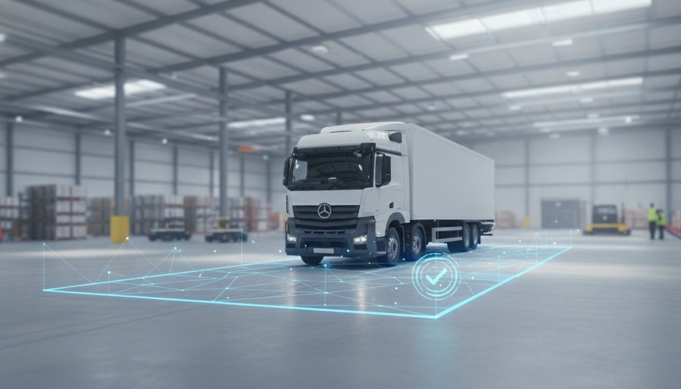
Step-by-Step Guide: Setting Up Your First Delivery Geofence
Before you begin setting up geofencing alerts for delivery zones, your GPS tracking hardware must be active and reporting live data. If your units aren't pinging the server, you can't draw accurate boundaries. Once you've confirmed your devices are online, navigate to the "Zones" or "Geofencing" tool in your fleet management software. This is typically found in the main tracking or settings menu.
Identify your delivery location using a standard UK postcode. For new industrial estates or rural depots where postcodes are less precise, use latitude and longitude coordinates. Switch to satellite view to see the actual physical footprint of the yard. This allows you to draw a boundary that matches the real-world fence line. After drawing the perimeter, select your trigger events—Entry, Exit, or Dwell—and assign the specific vehicles or trailers that require monitoring.
Mapping the Zone and Assigning Assets
Precision is the priority during the mapping phase. Overlay your polygon boundary directly onto the site's gates and unloading bays. Avoid including adjacent public roads to prevent false alerts. Once the shape is set, assign your assets using "Groups". You might create a specific rule for your HGV fleet while leaving your van tracking data for general monitoring. This ensures you aren't overwhelmed by notifications from vehicles that don't need arrival tracking.
Naming conventions are often overlooked but vital for clarity. A notification that says "Zone 1 Entry" is useless during a busy shift. Use a structured format like "Site_ClientName_City". This tells your dispatcher exactly what is happening without them needing to look at a map. Clear communication starts with how you organise your data. It saves seconds during an alert, and those seconds add up across a large fleet.
Testing and Validation in the Field
Don't assume your first boundary is perfect. Validation requires monitoring the first few "live" entries and exits. If a driver triggers an arrival alert whilst still waiting at a set of traffic lights outside the gate, your polygon is too large. Tighten the perimeter until it only triggers when the vehicle is truly on-site. This prevents the transport office from acting on premature data.
Adjust your dwell thresholds based on real-world performance. If a specific customer usually takes 90 minutes to unload, set your dwell alert for 105 minutes. This ensures you only get notified of genuine delays. You can also use historical trip data to test your rules. Run a report for the last seven days to see if your new geofence would have correctly identified past arrival times. This retroactive check proves the logic works before you commit to live alerts.
Ready to start securing your delivery zones? Order your GPS fleet tracking hardware to build your first virtual perimeter today.
Optimising Fleet Performance with Fleetalyse Geofencing Solutions
Fleetalyse bridges the gap between basic GPS tracking and full transport compliance. Setting up geofencing alerts for delivery zones is far more effective when linked to your tachograph data. Our platform allows you to monitor live driver hours alongside vehicle location in real time. You don't just see that a vehicle has arrived. You know immediately if the driver has enough remaining hours to complete the next scheduled drop. This single-platform approach removes the friction of switching between different software packages. It ensures your data remains consistent and your dispatchers stay focused. By integrating these systems, you create a holistic view of your fleet's performance and regulatory status.
Beyond Alerts: Geofence Reporting for Better Decisions
Real-time alerts are for immediate action. Long-term data is for driving profitability. Our reporting tools turn geofence entries and exits into a performance map of your entire customer network. You can identify which sites cause persistent delays and which are your most efficient. Automated weekly reports show the total time spent at customer locations. This provides the objective evidence needed to address bottlenecks with site managers. You can also link geofence exits to remote tachograph download schedules. When a vehicle leaves your yard, the system can trigger a download automatically. This keeps your records current and supports the "continuous and effective control" required to protect your Operator Licence. It's about moving from simple alerts to a comprehensive management strategy.
Getting Started with Fleetalyse Tracking
We are a UK-based specialist. Our hardware is built for the rigours of the British haulage industry. Whether you require van tracking or trailer tracking, our units are straightforward to install and report with high frequency. We prioritise operational clarity and transparent costs. You get the data you need without hidden complexities or marketing hyperbole. Our support team understands the specific challenges of UK infrastructure and regulations. They provide practical help in configuring complex delivery networks and managing setting up geofencing alerts for delivery zones across national fleets. This localised expertise ensures your tracking system is built for real-world application rather than theoretical data collection. You can visit Fleetalyse to browse our range of tracking hardware and start improving your fleet's security and efficiency today.
Take Control of Your Delivery Operations
Haulage is a game of margins and precision. You can't afford to waste time on manual tracking or suffer the risks of unauthorised vehicle use. By setting up geofencing alerts for delivery zones, you replace guesswork with automated, reliable data. You've seen how polygon boundaries provide the accuracy needed for tight UK industrial estates and how dwell alerts help you recover costs from customer delays. This isn't just about dots on a map; it's about building a rules-based control layer that protects your business.
Efficiency isn't about collecting data for the sake of it; it's about making that data work for your transport office. Fleetalyse provides the real-time GPS visibility you need for vans, HGVs, and trailers, all backed by specialised UK transport compliance experts. We offer transparent pricing with no hidden complexities, so you know exactly what you're paying for from day one. Our platform ensures your tracking and tachograph data work together to support your Operator Licence requirements.
It's time to move beyond reactive tracking and start managing by exception. Take the next step to professionalise your fleet management. Organise your fleet tracking and geofencing with Fleetalyse today and build a more secure, efficient operation.
Frequently Asked Questions
What is the difference between a circular and a polygon geofence?
A circular geofence uses a simple radius around a central coordinate, whilst a polygon geofence allows you to draw a custom shape. Circular zones are faster to set up but often capture adjacent roads, leading to false alerts. Polygon zones are essential for setting up geofencing alerts for delivery zones in busy urban areas. They follow the exact perimeter of a yard, ensuring you only receive a notification when a vehicle truly enters the site.
How accurate are geofencing alerts for urban deliveries?
Accuracy is typically within 5 to 10 metres, though "urban canyons" with tall buildings can cause slight GPS drift. You can mitigate this by using a 15 metre buffer zone around your perimeter. This margin of error prevents erratic alerting caused by signal bounces. High-quality hardware and frequent reporting intervals ensure that even in dense city centres, your arrival and departure timestamps remain reliable for customer reporting and operational logs.
Can I set up geofence alerts for my trailers as well as my HGVs?
You can monitor both asset types. Fleetalyse provides specific hardware for trailer tracking and HGV tracking, allowing you to apply geofence rules across your entire fleet. This is particularly useful for securing trailers left at third-party sites or monitoring high-value assets. Setting up geofencing alerts for delivery zones for trailers ensures you have a digital log of exactly when an asset was dropped off or collected by a subcontractor or driver.
Will geofencing alerts drain the battery on my tracking devices?
Hard-wired tracking devices draw minimal power from the vehicle's battery and won't cause issues during normal operation. For non-powered assets like trailers, battery life depends on the reporting interval. Setting a 60 second ping provides high accuracy without overtaxing the battery. Most modern asset trackers are designed to last months or even years by using efficient power-management logic that only triggers high-frequency reporting when movement is detected by the unit.
How many geofences can I set up for my delivery zones?
Most professional platforms support hundreds of virtual boundaries. However, you should prioritise your most critical delivery sites to prevent alert fatigue. Focus on high-value customer yards, regional distribution centres, and your own depots. By categorising these zones by operational priority, you ensure your transport office only receives notifications that require immediate action or specific customer service updates, rather than being overwhelmed by routine data points.
Can I receive geofence alerts on my mobile phone whilst out of the office?
Most modern fleet management systems allow you to receive alerts via SMS or email directly on your smartphone. This ensures you stay informed about critical events, such as unauthorised out-of-hours movements, even when you aren't at your desk. You can configure the system to send high-priority security alerts to your phone whilst routing routine arrival notifications to the main office email address for general monitoring and administrative record-keeping.
Do I need special software to set up geofencing for my fleet?
You don't need a separate standalone program. Geofencing is a standard feature within professional GPS fleet tracking platforms like Fleetalyse. Once your hardware is installed, you access the geofencing tools through your web browser or mobile app. The software handles the complex logic of matching GPS coordinates to your virtual boundaries, so you only need to draw the zones and select your notification preferences within the existing interface.
How does geofencing help with UK Operator Licence compliance?
Geofencing demonstrates "continuous and effective control" over your fleet, which is a core requirement for a UK Operator Licence. It provides a digital audit trail of all vehicle movements and helps prevent unauthorised use or "side jobs" that increase risk. When integrated with tachograph analysis, it helps you cross-reference GPS locations with driver records, proving that your operation is managed with a high degree of professional competence and digital oversight.
Frequently asked questions
Radial vs. Polygon Zones: Which to Choose?
Radial zones are the simplest form. They create a circular perimeter around a specific GPS coordinate. These are ideal for simple proximity alerts or monitoring assets in large, open areas like rural depots. However, they lack the granularity needed for tight urban environments. If a customer's warehouse sits next to a busy A-road, a radial zone might trigger every time a vehicle passes by on the main carriageway. Polygon zones allow you to draw custom shapes that match the exact footprint of a delivery site. This is crucial for avoiding false positives. A polygon zone ensures the alert only fires when the vehicle actually enters the yard. Beyond these shapes, "corridor" geofencing allows you to monitor specific transit routes. This is particularly useful for ensuring drivers stick to approved paths or stay clear of restricted areas like Clean Air Zones.
What is the difference between a circular and a polygon geofence?
A circular geofence uses a fixed radius around a single GPS coordinate, while a polygon geofence allows you to draw a custom shape. Polygons are essential for UK hauliers operating in tight urban yards where a circle might overlap onto a main road. This precision ensures you only receive alerts when a vehicle genuinely enters the site perimeter rather than just driving past the entrance.
How accurate are geofencing alerts for urban deliveries?
Geofencing is highly accurate but can be affected by "urban canyons" in cities like London or Manchester where tall buildings obstruct satellite signals. Setting up geofencing alerts for delivery zones with a 10-20 metre buffer helps mitigate this issue. This margin of error prevents false alerts caused by GPS drift while the vehicle is stationary, ensuring your data remains reliable in dense environments.
Can I set up geofence alerts for my trailers as well as my HGVs?
Yes, you can set up alerts for trailers using dedicated trailer tracking hardware. This is particularly useful for monitoring assets left at third-party sites or customer yards for extended periods. It provides real-time visibility and ensures you are notified the moment a trailer is moved, enhancing security and helping you maintain control over your entire national fleet.
Will geofencing alerts drain the battery on my tracking devices?
Geofencing won't drain the battery of HGV or van trackers as they are powered directly by the vehicle. For non-powered assets like trailers, the battery life depends on the reporting frequency you select. Most modern hardware is designed to balance location accuracy with power conservation, ensuring long-term reliability without the need for constant maintenance or frequent recharging.
How many geofences can I set up for my delivery zones?
Most professional fleet management platforms allow you to set up an unlimited number of geofences. However, the focus should always be on quality over quantity to avoid overwhelming your traffic office. We recommend prioritising high-value sites and frequent delivery points first. This ensures your dispatchers stay focused on actionable data rather than a constant stream of non-urgent notifications.
Can I receive geofence alerts on my mobile phone whilst out of the office?
Yes, alerts can be sent directly to your mobile phone via SMS, email, or push notifications from your tracking app. This allows transport managers to stay informed about critical events, such as unauthorised vehicle movements or delivery arrivals, without being tethered to a desktop. It's a practical solution for maintaining oversight whilst managing other aspects of the business on-site.
Do I need special software to set up geofencing for my fleet?
You don't need separate software if you are already using a comprehensive fleet management platform. Setting up geofencing alerts for delivery zones is a standard feature of professional GPS tracking systems. You simply need the active hardware reporting to a dashboard that supports zone creation and rule-based notifications. This integration ensures all your tracking and compliance data is held in one place.
How does geofencing help with UK Operator Licence compliance?
Geofencing supports your Operator Licence by providing objective evidence of "Continuous and Effective" control over your vehicles. It logs every arrival and departure, proving that you have robust systems in place to monitor driver activity and asset security. This automated record-keeping is invaluable during DVSA audits or when demonstrating your operational standards to the Traffic Commissioner.